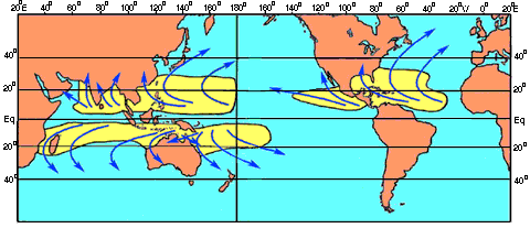
The majority of Australian cyclones form
off the NW coast of Australia in the Indian
Ocean, or off the NE coast in the Coral
Sea . The Arafura Sea off the NW of the Northern
Territory may also see the formation of
cyclones but not to the same degree as the latter
two areas.
None the less Australia's most famous cyclone,
Cyclone Tracy did form in that area. The
only other area that cyclones form is in
the Gulf of Carpentaria. According to reference
books I have read this is not common. Yet
just about every year for the past few has seen
at least one cyclone form there. El Ninò
which pushes Tropical Cyclone development
further eastwards in the Coral Sea / Pacific
ocean than normal also has less affect over
the semi enclosed waters of the Gulf of
Carpentaria.
Tropical cyclones may affect four Australian
states. The two most commonly affected
states are Queensland and Western Australia.
The Northern Territory is affected by
cyclones very occasionally. New South Wales
on very rare occasions may feel the affects
of a cyclone.
The entire Queensland coastline is open to
tropical cyclones. Generally the more stronger
destructive cyclones cross the Queensland
coast between Cooktown and Rockhampton.
The coast between Townsville and Mackay
is particularly at risk because of its more NW
- SE direction. The last destructive cyclone
to cross the Queensland coast was Cyclone
Aivu in April 1989 which crossed the coast
south of Townsville near the towns of Ayr and
Home Hill. Winds were close to 200 km/h
( 125 mph ).
Other famous Queensland cyclones have been
Cyclone Athea which struck Townsville in
December 1971 with winds near 200 km/h (
125mph ). Athea brought with it a 3m ( 10ft )
storm surge, and caused $50 million worth
of damage. Many Queensland cyclones are
destructive not for their winds but for
the large amount of rain that can accompany them.
Cyclone Wanda in February 1974 was an example
of this with floods in Brisbane and most
of SE Queensland.
The strongest Australian cyclones have crossed
Western Australia's NW coast. This
coast is so sparsely populated that often
cyclones which would cause massive destruction
in settled areas, cross the coast here without
much media fanfare. Could you imagine a
Category 4 Hurricane crossing the US coast
and being ignored by the media. Well it has
happened here ! Only the extreme SW and
southern coasts of Western Australia are
cyclone free. The most at risk area is the
section of coast from Broome to Shark Bay. In
December 1975 Cyclone Joan crossed the Western
Australian coast about 30 miles from
Port Hedland, even so winds in Port Headland
gusted to 212 kph ( 132 mph ). Damage was
about $20 million. The highest ever recorded
wind gust in Australia was associated with a
cyclone in Australia's NW. This was recorded
near Onslow with winds reaching 259 km/p (
160 mph ). (THIS WAS WRITTEN BEFORE CYCLONE
VANCE 267kmh)
Although seeing fewer cyclones, the Northern
Territory has seen Australia's most famous
Topical Cyclone, Cyclone Tracy. Cyclone
Tracy hit Darwin on Christmas day 1974. Winds
gusted to 217 kp/h ( 135mph ). Damage was
over $200 million and 65 people were killed.
New South Wales is the only other state to
see Cyclones. For NSW they are a rare visitor
and usually have weakened by this stage.
The Northern Rivers and Mid North Coasts are
affected more by flooding rains rather than
destructive winds. Once a cyclone moves this
far south there is often severe isobar compression
between it and high pressure cells to
the south. This leads to a vigorous onshore
feed that can bring inches of rain. A broad
band of strong to gale force winds also
develops leading to large ocean swells that can
cause problems.
Australian cyclone
information taken from
http://ausweather.simplenet.com/
Back
to Geoff's severe weather page